![](/images/other/stat-length.png)
![Excursión Senderismo Le Mazeau - Village de La Sèvre - Photo](https://media.geolcdn.com/t/1900/400/ext.pjpeg?maxdim=2&url=https%3A%2F%2Fservices.sitytrail.com%2FGeolivesWS%2FDownloadMedia.ashx%3FTrailID%3D126835%26Media%3D20120511111934.jpeg)
Village de La Sèvre
olaze
Usuario
![Longitud](/images/other/stat-length.png)
Longitud
8,7 km
![Altitud máxima](https://static1.geolcdn.com/siteimages/upload/files/1508320355ic_sort_altitude_max_24dp.png)
Altitud máxima
10 m
![Desnivel positivo](https://static1.geolcdn.com/siteimages/upload/files/1508320355ic_sort_den_pos_24dp.png)
Desnivel positivo
45 m
![Km-Effort](/images/other/stat-length.png)
Km-Effort
9,3 km
![Altitud mínima](https://static1.geolcdn.com/siteimages/upload/files/1508320355ic_sort_altitude_min_24dp.png)
Altitud mínima
0 m
![Desnivel negativo](https://static1.geolcdn.com/siteimages/upload/files/1508320355ic_sort_den_neg_24dp.png)
Desnivel negativo
46 m
![Boucle](https://static1.geolcdn.com/siteimages/upload/files/16400158638029165_repeat_loop_refresh_sync_direction_icon.png)
Boucle
Sí
Fecha de creación :
2014-12-10 00:00:00.0
Última modificación :
2014-12-10 00:00:00.0
![Senderismo](https://static1.geolcdn.com/sitytour/trail-icons/101.png)
2h02
Dificultad : Fácil
![Escanee este código QR para abrir la excursión en la aplicación SityTrail](https://capi.geolives.com/qq0zvz2zws4bq2lad0pu/sitytour/trails/126835/qr.png?size=200)
Aplicación GPS de excursión GRATIS
A propósito
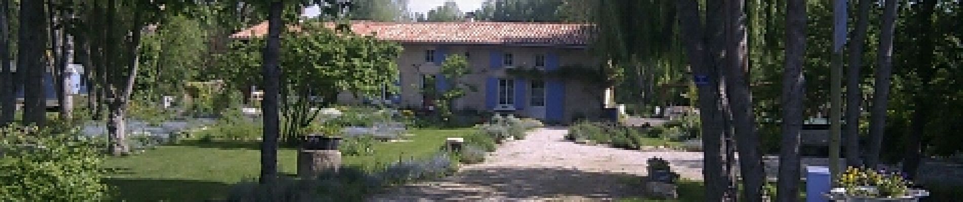
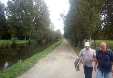
Ruta Senderismo de 8,7 km a descubrir en Países del Loira, Vandea, Le Mazeau. Esta ruta ha sido propuesta por olaze.
Descripción
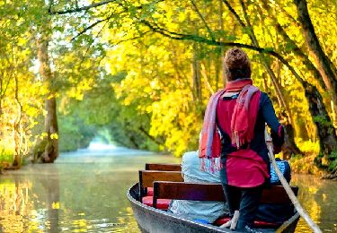
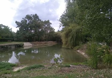
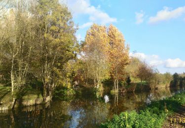
Agréable promenade dans le marais et bords de Sèvres.
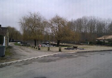
Départ et retour Le Mazeau.
Vers Le Village de Sèvre.
Club rando ATSCAF 79.
Localización
País:
France
Región :
Países del Loira
Departamento/provincia :
Vandea
Municipio :
Le Mazeau
Localidad:
Unknown
Salida:(Dec)
Salida:(UTM)
678958 ; 5133454 (30T) N.
Comentarios
Excursiones cerca
![Excursión Senderismo Arçais - Arçais - Photo](https://media.geolcdn.com/t/375/260/ext.jpg?maxdim=2&url=https%3A%2F%2Fservices.sitytrail.com%2FGeolivesWS%2FDownloadMedia.ashx%3FTrailID%3D154286%26Media%3D20120918154346.jpeg)
![Senderismo Senderismo](https://static1.geolcdn.com/sitytour/trail-icons/101.png)
Arçais
Senderismo
Fácil
(2)
Arçais,
Nueva Aquitania,
Deux-Sèvres,
France
![](/images/other/stat-length.png)
9,6 km | 10,2 km-effort
2h 25min
![](https://static1.geolcdn.com/siteimages/upload/files/16400158638029165_repeat_loop_refresh_sync_direction_icon.png)
Sí
![Excursión Bicicleta híbrida Le Mazeau - Cyclo dans le marais Poitevin - Photo](https://media.geolcdn.com/t/375/260/86905f3c-566b-4bf0-9e35-0be64feae71f.jpg&format=jpg&maxdim=2)
![Bicicleta híbrida Bicicleta híbrida](https://static1.geolcdn.com/sitytour/trail-icons/203.png)
Cyclo dans le marais Poitevin
Bicicleta híbrida
Fácil
Le Mazeau,
Países del Loira,
Vandea,
France
![](/images/other/stat-length.png)
48 km | 51 km-effort
4h 10min
![](https://static1.geolcdn.com/siteimages/upload/files/16400158638029165_repeat_loop_refresh_sync_direction_icon.png)
Sí
![Excursión Bicicleta Maillezais - Les Vals d'Autise Maillezais, Le Mazeau, Damvix, Maillé - Photo](https://media.geolcdn.com/t/375/260/ext.jpg?maxdim=2&url=https%3A%2F%2Fstatic1.geolcdn.com%2Fsiteimages%2Fupload%2Ffiles%2F1524743154velo.jpg)
![Bicicleta Bicicleta](https://static1.geolcdn.com/sitytour/trail-icons/200.png)
Les Vals d'Autise Maillezais, Le Mazeau, Damvix, Maillé
Bicicleta
Fácil
(1)
Maillezais,
Países del Loira,
Vandea,
France
![](/images/other/stat-length.png)
35 km | 37 km-effort
2h 13min
![](https://static1.geolcdn.com/siteimages/upload/files/16400158638029165_repeat_loop_refresh_sync_direction_icon.png)
Sí
![Excursión Senderismo Le Mazeau - Mazeau_Marais_Sauvage - Photo](https://media.geolcdn.com/t/375/260/c928f69a-d8cb-467b-bfde-89b85eb625c6.jpg&format=jpg&maxdim=2)
![Senderismo Senderismo](https://static1.geolcdn.com/sitytour/trail-icons/101.png)
Mazeau_Marais_Sauvage
Senderismo
Fácil
Le Mazeau,
Países del Loira,
Vandea,
France
![](/images/other/stat-length.png)
8,6 km | 9,2 km-effort
2h 45min
![](https://static1.geolcdn.com/siteimages/upload/files/16400158638029165_repeat_loop_refresh_sync_direction_icon.png)
Sí
![Excursión Senderismo Benet - Les Nattes - Photo](https://media.geolcdn.com/t/375/260/a97c3037-e825-40d3-8987-e43b5676dc7d.jpg&format=jpg&maxdim=2)
![Senderismo Senderismo](https://static1.geolcdn.com/sitytour/trail-icons/101.png)
Les Nattes
Senderismo
Fácil
Benet,
Países del Loira,
Vandea,
France
![](/images/other/stat-length.png)
9,8 km | 10,5 km-effort
3h 17min
![](https://static1.geolcdn.com/siteimages/upload/files/16400158638029165_repeat_loop_refresh_sync_direction_icon.png)
Sí
![Excursión Senderismo Coulon - Village de La Sèvre (pont Irleau)9,4km - Photo](https://media.geolcdn.com/t/375/260/fd1d97d5-7e71-4221-a960-75ca1377e151.jpg&format=jpg&maxdim=2)
![Senderismo Senderismo](https://static1.geolcdn.com/sitytour/trail-icons/101.png)
Village de La Sèvre (pont Irleau)9,4km
Senderismo
Fácil
Coulon,
Nueva Aquitania,
Deux-Sèvres,
France
![](/images/other/stat-length.png)
9,5 km | 10,1 km-effort
2h 15min
![](https://static1.geolcdn.com/siteimages/upload/files/16400158638029165_repeat_loop_refresh_sync_direction_icon.png)
Sí
![Excursión Senderismo Le Mazeau - Le Mazeau 1 - Photo](https://media.geolcdn.com/t/375/260/ext.jpg?maxdim=2&url=https%3A%2F%2Fservices.sitytrail.com%2FGeolivesWS%2FDownloadMedia.ashx%3FTrailID%3D843604%26Media%3Dfix__20171010154548.jpg)
![Senderismo Senderismo](https://static1.geolcdn.com/sitytour/trail-icons/101.png)
Le Mazeau 1
Senderismo
Fácil
Le Mazeau,
Países del Loira,
Vandea,
France
![](/images/other/stat-length.png)
8,6 km | 9,3 km-effort
2h 1min
![](https://static1.geolcdn.com/siteimages/upload/files/16400158638029165_repeat_loop_refresh_sync_direction_icon.png)
Sí
![Excursión Senderismo Le Vanneau-Irleau - Le Vanneau circuit sec - Photo](https://media.geolcdn.com/t/375/260/ext.jpg?maxdim=2&url=https%3A%2F%2Fservices.sitytrail.com%2FGeolivesWS%2FDownloadMedia.ashx%3FTrailID%3D201299%26Media%3D20130212154447.jpeg)
![Senderismo Senderismo](https://static1.geolcdn.com/sitytour/trail-icons/101.png)
Le Vanneau circuit sec
Senderismo
Fácil
Le Vanneau-Irleau,
Nueva Aquitania,
Deux-Sèvres,
France
![](/images/other/stat-length.png)
7,4 km | 7,9 km-effort
1h 53min
![](https://static1.geolcdn.com/siteimages/upload/files/16400158638029165_repeat_loop_refresh_sync_direction_icon.png)
Sí
![Excursión Senderismo Le Vanneau-Irleau - Le Vanneau circuit sec - Photo](https://media.geolcdn.com/t/375/260/ext.jpg?maxdim=2&url=https%3A%2F%2Fservices.sitytrail.com%2FGeolivesWS%2FDownloadMedia.ashx%3FTrailID%3D174924%26Media%3D20130212154447.jpeg)
![Senderismo Senderismo](https://static1.geolcdn.com/sitytour/trail-icons/101.png)
Le Vanneau circuit sec
Senderismo
Fácil
Le Vanneau-Irleau,
Nueva Aquitania,
Deux-Sèvres,
France
![](/images/other/stat-length.png)
7,4 km | 7,9 km-effort
1h 45min
![](https://static1.geolcdn.com/siteimages/upload/files/16400158638029165_repeat_loop_refresh_sync_direction_icon.png)
Sí